Spatial analytics powered by AI. Transform complex geospatial data into actionable intelligence across your organization.
Connect your geospatial data sources. Ask questions. Get decisions. No data scientists or GIS experts required.
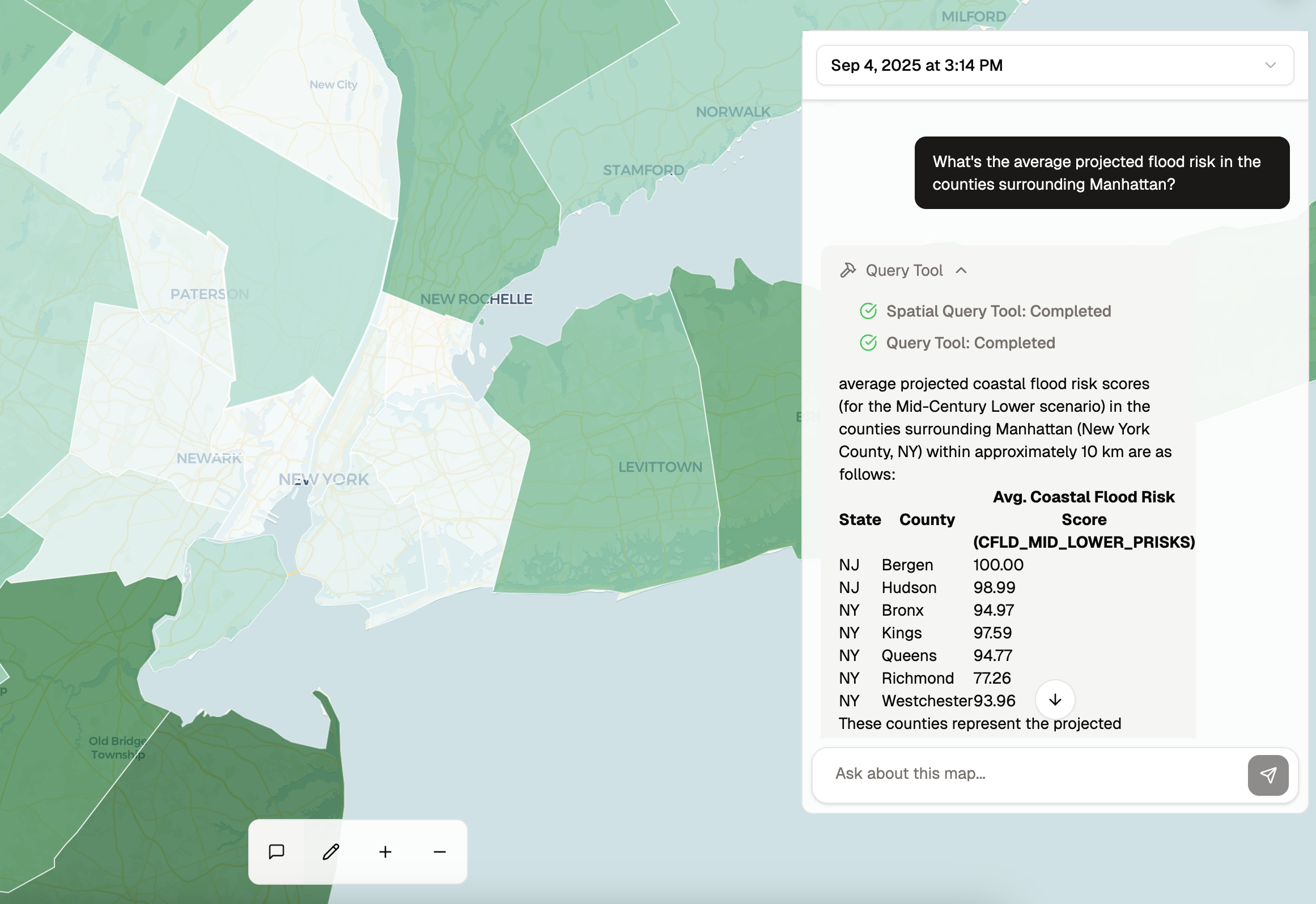
Ask your spatial data questions in plain language. Get clear answers and recommendations without writing queries or consulting experts. Our AI processes complex geospatial relationships and returns actionable insights.
Transform multi-source geospatial data into clear, actionable visualizations. Our platform automatically synthesizes disparate datasets into unified views that reveal patterns and guide decisions.
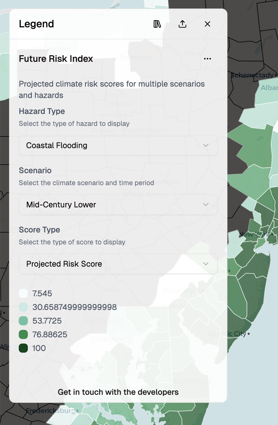
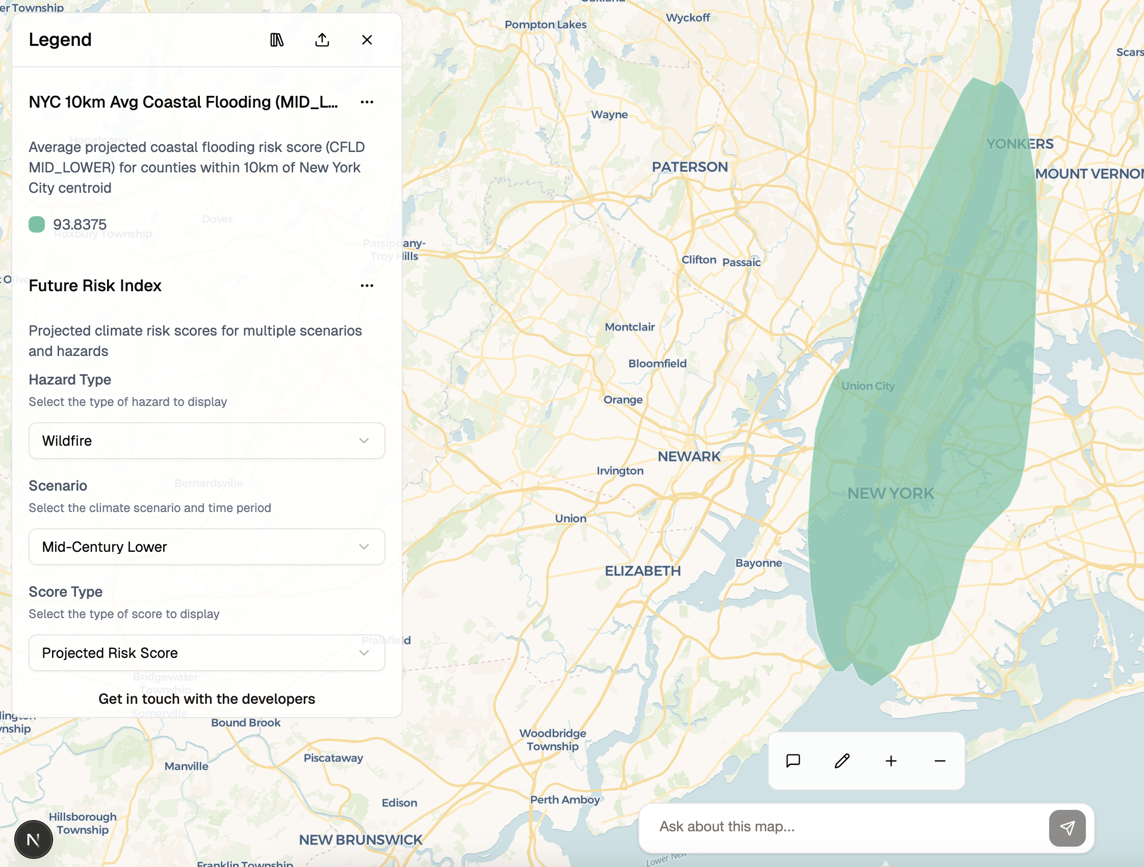
Generate spatial layers through natural language—no GIS expertise required. Our platform understands complex spatial relationships and automatically constructs the analysis your team needs to make decisions.
Connect PostGIS databases, feature servers, and data warehouses into a unified spatial network. Automatically understand spatial schemas, coordinate systems, and geographic relationships.
Monitor spatial analytics usage across your team. Track query patterns, identify critical insights, and understand how spatial data drives decision-making throughout your operations.
Bank-grade security with SSO, role-based access control, and audit logging. Keep sensitive spatial data protected while enabling secure collaboration across your workforce.
See how teams use spatial analytics to make decisions across risk assessment, disaster analysis, and strategic planning.
Visualize USDA Section 502 housing investment distribution across the Eastern United States. Explore county-level investment per capita data to identify patterns in rural housing development and understand where federal housing assistance is making the greatest impact.
Custom pricing tailored to your team's spatial analytics needs. Scale from pilot to company-wide deployment.
For teams making data-driven spatial decisions
Volume discounts and custom pricing available
Deploy spatial analytics across your operations. Connect your data sources. Build your spatial network.
✓ Production-grade security • ✓ Custom integrations • ✓ Dedicated support